NASA's CASALS lidar steers its laser with colour, not mirrors
NASA Goddard's CASALS lidar sweeps 256 laser wavelengths across the ground to map forests and terrain as continuous 3D swaths, not thin lines. How it works.
LandGadget Newsroom · · 3 min read
On this page
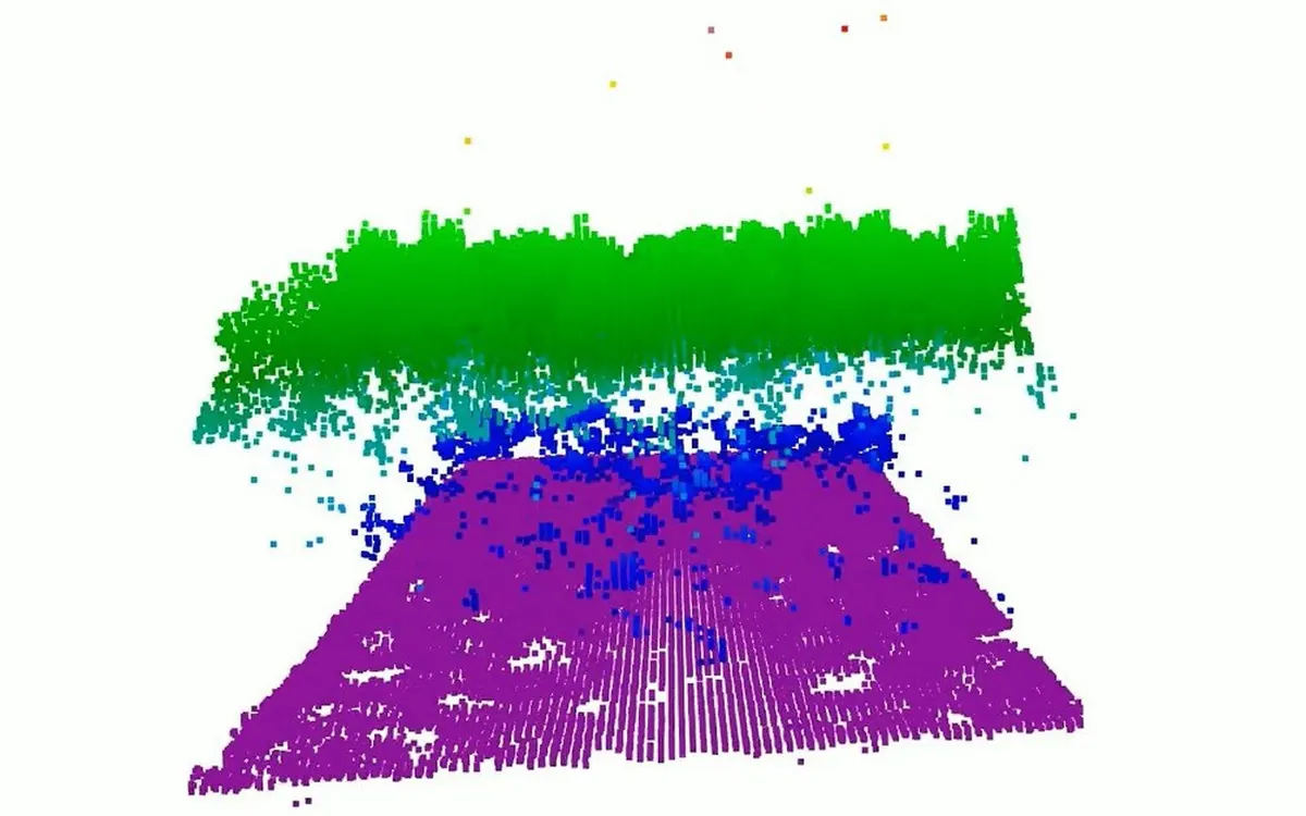
Satellite lasers already measure the height of Earth's forests and ice, but only along narrow lines, with wide strips of unmeasured land in between. A new instrument from NASA's Goddard Space Flight Center aims to fill those gaps. NASA described it on 21 October. It is called CASALS, short for Concurrent Artificially-intelligent Spectrometry Lidar System, and it scans a continuous 3D swath of the ground instead of a single track.
How it works
Most scanning lidars aim their laser with moving mirrors, which are heavy, use power and can wear out in space. CASALS has no moving parts in the beam path. It uses the laser's wavelength to steer.
- A fast-pulsing, tunable "seed" laser centred on 1,040 nanometres cycles through 256 slightly different wavelengths.
- Each pulse passes through a transmission grating, an optical part covered in microscopic ridges.
- Diffraction bends each wavelength at a slightly different angle, so the 256 pulses fan out across the flight path, each landing in its own spot.
The result is a sweep across the ground with no mechanical scanner, which NASA says greatly reduces size, weight and power, and makes the instrument more reliable in orbit.
The other trick is the detector. CASALS converts about 80% of returning photons into signal, a measure called quantum efficiency. With so little light wasted, it can pick up faint echoes from dark surfaces or through dense vegetation. Machine learning, the "artificially intelligent" part of the name, will help it adapt how it sweeps the surface.
From aircraft to orbit
CASALS so far
Nov 2024
First airborne flight
A prototype flew on NASA's B200 King Air at about 5 km altitude and returned science-quality data on its first campaign.
Oct 2026
Results published
NASA reports 22 cm horizontal resolution, fine enough to pick out individual tree branches and small changes in ground height.
Summer 2027
ASCENT campaign
The team plans to fly CASALS again in NASA's airborne surface, cryosphere, ecosystem and nearshore topography campaign.
Next
Space-ready prototype
Engineers are widening the swath and adding onboard data processing before building a version for orbit.
"This worked really well from the first time we flew it," principal investigator John Yorks said. NASA hasn't announced a satellite mission or launch date for CASALS. If it does reach orbit, it could be the first spaceborne lidar to map forests and terrain as continuous 3D swaths, giving a much fuller picture of how forests, ice and coastlines change.
For more from NASA's busy month, see the new Moon base rovers, or look up instead with our beginner telescope guide.
More from Science & Space
View all →Read next
VW battery recall now covers 72,700 ID. EVs worldwide
Volkswagen is recalling about 72,700 ID.3, ID.4, ID.7, ID. Buzz and Cupra Born EVs over faulty battery cells. Which cars are affected and what owners should do.
OpenAI's GPT-6 models are coming to Google Cloud
GPT-6 Astra, GPT-6.1 Sol and GPT-6 Luna are entering private preview in Google Cloud's model garden. OpenAI models will now be on all three big US clouds.
Aqara Outdoor Plug H2 EU: Thread or Zigbee mode?
Aqara's €32.99 IP44 outdoor plug runs on Thread (Matter, no hub) or Zigbee (Aqara hub, more features). Here is what each mode gives you and which to pick.